c1863 Magnus Letter Sheet Map Civil War Virginia & Washington D.C.
c1863 Magnus Letter Sheet Map Civil War Virginia & Washington D.C.
Couldn't load pickup availability
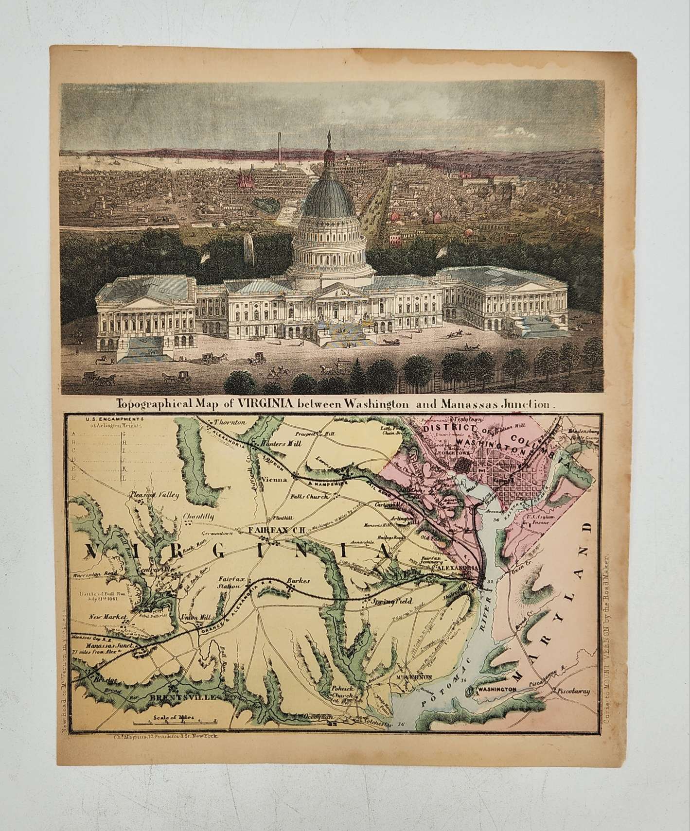
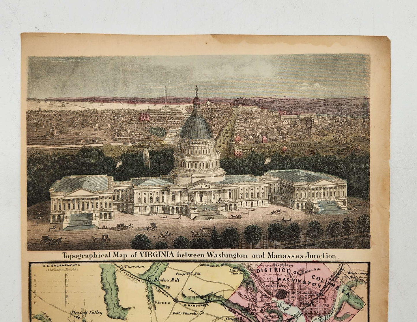
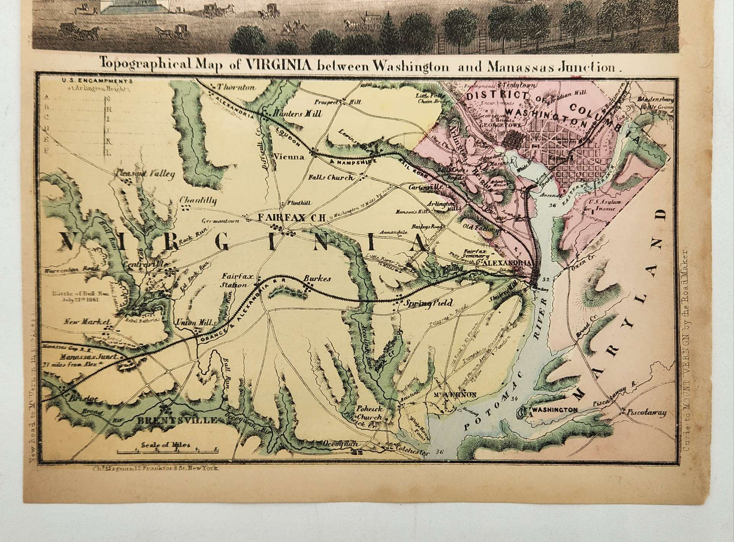
TOPOGRAPHICAL MAP OF WASHINGTON BETWEEN VIRGINIA AND MANASSAS JUNCTION.
Hand-colored letter sheet map, published by Charles Magnus, New York, ca. 1863
Image size: 9 x 7.5 inches. Sheet size: 10 x 8.25 inches.
Denotes “Battle of Bull Run, July 21st 1861” near New Market, with locations of “Rebel” and “U.S.” positions.
Blank list of “U.S. Encampments at Arlington Heights,” labeled A through L in upper left corner.
The upper half of the map features a bird’s-eye view of the U.S. Capitol as seen from the front of the building looking west, with a preliminary design of the unfinished Washington Monument in the distance.
The map likely dates from 1863 because the statue of Freedom was not installed on top of the Capitol dome until 1863.
Text on vertical side of lower left corner reads “New road to Mt. Vernon in progress.”
Text on horizontal side of lower left corner reads, “Chs. Magnus, 12 Frankford St., New York.”
Text on vertical side of lower right corner reads “Guide to Mount Vernon by the Road Maker.”
Please note: We have multiple copies of this map. All are in similar condition but may have different minor issues on the edges.


We have thousands of unique items at our location just a few minutes from the French Quarter. When you're in the New Orleans area, come by and see us!


